


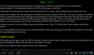


ISS?

Deskripsi ISS?
The ISS (International Space Station), completing one orbit around the earth every 92 minutes, approximately.
This application places the ISS on the map in real time.
Calculate the orbit from the current time of device and TLE data, which obtained www.celestrak.com.
Green line is drawn 50 minutes before and after the current position of the ISS.
The user's position is marked with an android with the arm held high, surrounded by a semi-transparent red circle.
The red circle indicates approximately the area where the ISS would be visible by the user. That is, if the ISS is inside the circle, in theory, you could watch it at the sky. Remember, NEVER LOOK DIRECTLY AT THE SUN!
Internet access is used to obtain maps and update once a day TLE data. More zoom means more data traffic.
From the preferences menu you can enable/disable automatic tracking on the map.
The local time Can also be superimposed on the map.
Visible Passes.
Although you can get to see the ISS for the day is much easier to see at night, because in the night sky is the second brightest object after the Moon and before of Venus.
But to be visible at night must be some circumstances:
-The ISS must be illuminated by the sun, ie outside the cone of shadow of the Earth.
-The sun must be at least 10 degrees below the horizon or, in other words, must have had at least 40 minutes before or must miss more than 40 minutes to come out.
-In its pass, the ISS must rise more than 5 degrees above the horizon. Less than 5 degrees is not visible by the distortion generated by the atmosphere.
From the main application window, pressing the menu key you can select "Visible Pass".
From this screen we have the date, time and position of the observer and a refresh button (circular arrow).
Pressing the button proceed to calculate the visible pass for the next 2 days (changeable in preferences screen).
The result is a list of steps visible. Each step consists of:
-Day and month.
-Initial instant. Time, altitude in degrees, azimuth in degrees (cardinal point equivalent)
-Instant of Maximum altitude. Time, altitude in degrees, azimuth in degrees (cardinal point equivalent)
-Final instant. Time, altitude in degrees, azimuth in degrees (cardinal point equivalent)
Alarms: You can on/off pressing alarm button (top-left icon).
3D Locator.
The locator uses accelerometer, the compass of the device and the calculated data to show the position of the ISS on sky from observer's position.
That is, when we moves the device to the sky shows a red triangle in the position of the ISS and a green dotted line showing the visible pass.
It also includes a positioning aid, based vibration:
- Hold the device pointing to the horizon, turn on your feet so as to vary only the azimuth (N, NE, E, SE, S, SW, W, NW). When the azimuth differs from the ISS in less than 10 ° there is a vibration.
- Now vary the altitude, vibration intensifies as it approaches the ISS and will be greatest when the red triangle is displayed.
- You can activate / deactivate the vibration by touching the screen.
Notes:
Altitude: The angle of a celestial object measured upward from the horizon of the observer. An object on the horizon has altitude 0 ° while one directly overhead the observer is 90 °.
Azimuth: The direction of celestial object measured along the direction of clockwise from the northern horizon of the observer. An object in the north has azimuth 0 °, east 90 °, south 180 ° and 270 ° west
Extensions:
If you like the app you can donate to developer from Extensions menu.
Thanks.ISS (International Space Station), menyelesaikan satu orbit mengelilingi bumi setiap 92 menit, kira-kira.
Aplikasi ini menempatkan ISS pada peta secara real time.
Hitung orbit dari waktu saat ini perangkat dan TLE data, yang diperoleh www.celestrak.com.
Jalur hijau ditarik 50 menit sebelum dan sesudah posisi saat ini dari ISS.
Posisi pengguna ditandai dengan android dengan lengan terangkat tinggi, dikelilingi oleh lingkaran merah semi-transparan.
Lingkaran merah menunjukkan sekitar daerah dimana ISS akan terlihat oleh pengguna. Artinya, jika ISS berada di dalam lingkaran, dalam teori, Anda bisa menonton di langit. Ingat, PERNAH MELIHAT LANGSUNG DI SUN!
Akses internet digunakan untuk memperoleh peta dan memperbarui sekali sehari Data TLE. Lebih zoom berarti lebih banyak lalu lintas data.
Dari menu preferensi Anda dapat mengaktifkan / menonaktifkan pelacakan otomatis pada peta.
Waktu setempat juga dapat ditumpangkan pada peta.
Passes terlihat.
Meskipun Anda bisa mendapatkan untuk melihat ISS untuk hari jauh lebih mudah untuk melihat di malam hari, karena di langit malam adalah objek paling terang kedua setelah bulan dan sebelum Venus.
Tetapi untuk menjadi terlihat pada malam hari harus beberapa keadaan:
-The ISS harus diterangi oleh matahari, yaitu di luar kerucut bayangan Bumi.
-Matahari harus minimal 10 derajat di bawah cakrawala atau, dengan kata lain, harus memiliki setidaknya 40 menit sebelum atau harus kehilangan lebih dari 40 menit untuk keluar.
-Dalam lulus nya, ISS harus naik lebih dari 5 derajat di atas cakrawala. Kurang dari 5 derajat tidak terlihat oleh distorsi yang dihasilkan oleh atmosfer.
Dari jendela utama aplikasi, menekan tombol menu Anda dapat memilih "Terlihat Lulus".
Dari layar ini kita memiliki tanggal, waktu dan posisi pengamat dan tombol refresh (panah melingkar).
Menekan tombol lanjutkan untuk menghitung lulus terlihat untuk 2 hari ke depan (berubah dalam layar preferensi).
Hasilnya adalah daftar langkah-langkah yang terlihat. Setiap langkah terdiri dari:
Hari dan bulan.
-Awal instan. Waktu, ketinggian dalam derajat, azimuth dalam derajat (titik kardinal setara)
-Instant ketinggian maksimum. Waktu, ketinggian dalam derajat, azimuth dalam derajat (titik kardinal setara)
Akhir-instan. Waktu, ketinggian dalam derajat, azimuth dalam derajat (titik kardinal setara)
Alarm: Anda dapat on / off menekan tombol alarm (ikon kiri atas).
3D Locator.
Locator menggunakan accelerometer, kompas perangkat dan data yang dihitung untuk menunjukkan posisi ISS pada langit dari posisi pengamat.
Artinya, ketika kita bergerak perangkat ke langit menunjukkan segitiga merah di posisi ISS dan garis putus-putus hijau menunjukkan terlihat lulus.
Ini juga termasuk bantuan positioning, getaran berdasarkan:
- Memegang perangkat menunjuk ke cakrawala, nyalakan kaki Anda sehingga bervariasi hanya azimuth (N, NE, E, SE, S, SW, W, NW). Ketika azimuth berbeda dari ISS dalam waktu kurang dari 10 ° ada getaran.
- Sekarang bervariasi ketinggian, getaran mengintensifkan saat mendekati ISS dan akan terbesar ketika segitiga merah akan ditampilkan.
- Anda dapat mengaktifkan / menonaktifkan getaran dengan menyentuh layar.
Catatan:
Ketinggian: Sudut benda langit diukur ke atas dari horizon pengamat. Sebuah benda di cakrawala memiliki ketinggian 0 ° sementara satu tepat di atas kepala pengamat adalah 90 °.
Azimuth: Arah benda langit diukur sepanjang arah jarum jam dari atas cakrawala utara pengamat. Sebuah benda di utara memiliki azimuth 0 °, 90 ° timur, selatan 180 ° dan 270 ° BB
Ekstensi:
Jika Anda ingin aplikasi Anda dapat menyumbang untuk pengembang dari menu Extensions.
Terima kasih.
ISS? - Versi 2.2
(22-04-2015)
ISS? - Informasi APK
Versi APK: 2.2Paket: com.androidesimple.issVersi Terakhir dari ISS?


 4.33
4.33 3.55
3.55


Aplikasi pada kategori yang sama


Anda juga mungkin suka...
Aplikasi pada kategori yang sama


